Industrial Drone Solutions · Malaysia

Aerial intelligence for the industries that build Malaysia

From paddy granaries in Kedah to offshore platforms, city skylines and the borders of Sabah — Exceed builds AI-powered industrial drones and data platforms for agriculture, infrastructure inspection, urban planning, and national security.

6Aircraft platforms
4.5hMax endurance (VTOL)
±2.5cmRTK positioning
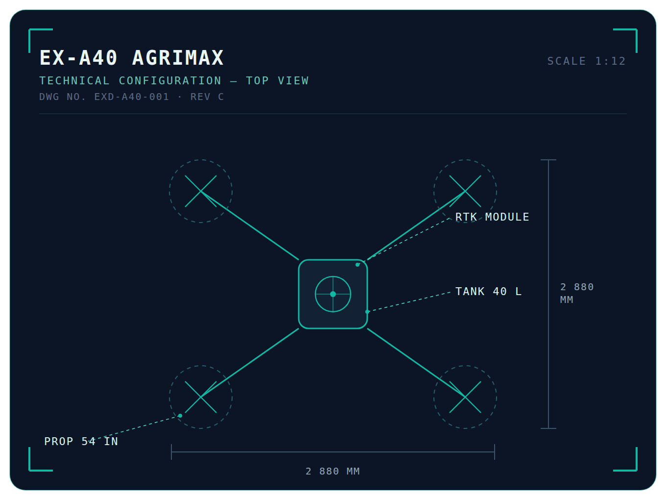
EX-A40 AGRIMAX TECHNICAL CONFIGURATION — TOP VIEW DWG NO. EXD-A40-001 · REV C SCALE 1:12 RTK MODULE TANK 40 L PROP 54 IN 2 880 MM 2 880 MM
CAAM-compliant operations RTK centimetre precision AI crop analytics Multispectral & LiDAR imaging Thermal EO/IR payloads BVLOS-capable platforms
What's Driving the Field

Technology that pays for itself, season after season

Agri-tech is moving fast. We build the trends that matter into every Exceed aircraft — not as buzzwords, but as measurable savings per hectare.

AI Crop Intelligence

On-board vision models detect pest hotspots, nutrient stress and lodging in real time — so you treat only where it's needed, not the whole block.

RTK Centimetre Precision

±2.5 cm positioning keeps swath lines perfect along bunds and terraces — zero overlap, zero skipped strips, even in GPS-shadowed estates.

Multispectral NDVI Mapping

Five-band sensors turn every flight into a crop-health map. Spot stress two weeks before the human eye can — while there's still time to act.

Swarm Operations

One operator, up to three aircraft. Fleet autonomy coordinates spray runs across large estates and finishes blocks in a single morning window.

Variable-Rate Application

Prescription maps drive the pumps: more input where the crop needs it, less where it doesn't. Typical chemical savings of 20–30% per cycle.

Digital Twin of Your Farm

Every flight updates a living 3D model of your land — terrain, canopy, drainage — powering season-on-season decisions, not just one-off maps.

The Fleet

One fleet, from farm to frontier

Monsoon humidity, dense canopy, offshore salt air, highland terrain — every Exceed aircraft is engineered and tested for the way Malaysia actually works.

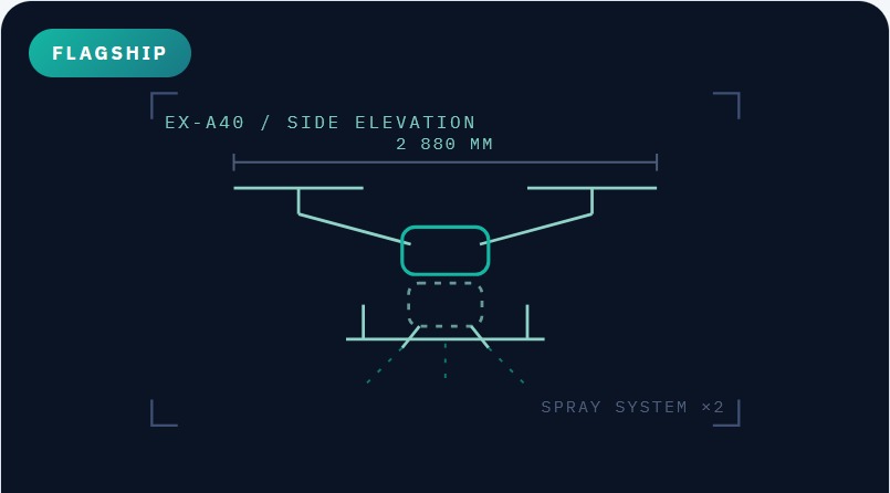
Flagship EX-A40 / SIDE ELEVATION SPRAY SYSTEM ×2 2 880 MM

EX-A40 AgriMax

Heavy-Lift Spraying Drone

Our workhorse for paddy and estate spraying. 40-litre tank, dual atomising nozzles, and terrain-follow radar for consistent droplet coverage on uneven land.

  • Tank capacity40 L spray / 50 kg spread
  • Coverageup to 21 ha / hour
  • PositioningRTK ±2.5 cm
  • RatingIPX6K, monsoon-ready
Get Pricing
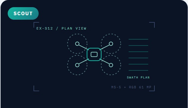
Scout EX-S12 / PLAN VIEW MS-5 + RGB 61 MP SWATH PLAN

EX-S12 FieldScout

Multispectral Survey Drone

A lightweight mapping platform with a 5-band multispectral camera and 61 MP RGB sensor. Flies a 120-hectare NDVI survey before your morning coffee is cold.

  • Flight time55 minutes
  • Sensors5-band MS + 61 MP RGB
  • Survey rateup to 300 ha / flight
  • OutputsNDVI, NDRE, DEM, ortho
Get Pricing
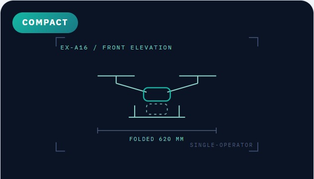
Compact EX-A16 / FRONT ELEVATION SINGLE-OPERATOR FOLDED 620 MM

EX-A16 Lite

Smallholder Spraying Drone

Right-sized for smallholder paddy plots and vegetable farms. 16-litre tank, one-person operation, folds into a pickup bed — priced for co-ops and service providers.

  • Tank capacity16 L
  • Coverageup to 10 ha / hour
  • Setup time< 3 minutes
  • Ideal forco-ops & service teams
Get Pricing
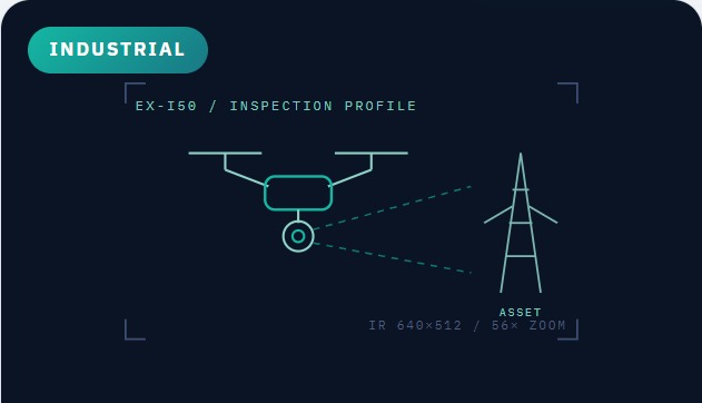
Industrial EX-I50 / INSPECTION PROFILE IR 640×512 / 56× ZOOM ASSET

EX-I50 InspectPro

Industrial Inspection Drone

Thermal + 56× zoom on a weatherproof airframe. Flare stacks, transmission lines, telco towers, rooftop solar — inspected without scaffolding, shutdowns or rope teams.

  • Payload640×512 radiometric IR + 56× zoom
  • Flight time45 minutes
  • RatingIP55, 12 m/s wind
  • Ideal forO&G, TNB grid, telco
Get Pricing
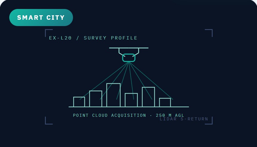
Smart City EX-L20 / SURVEY PROFILE LIDAR 5-RETURN POINT CLOUD ACQUISITION · 250 M AGL

EX-L20 CityMapper

LiDAR Urban Mapping Drone

Survey-grade LiDAR and oblique photogrammetry for city digital twins. Cadastral surveys, flood modelling, slope monitoring and development planning at PLANMalaysia standards.

  • LiDAR range250 m, 5 returns
  • Accuracy3 cm vertical (AGL 100 m)
  • Outputs3D twin, DEM/DSM, contour
  • Ideal forPBT, developers, JMG
Get Pricing
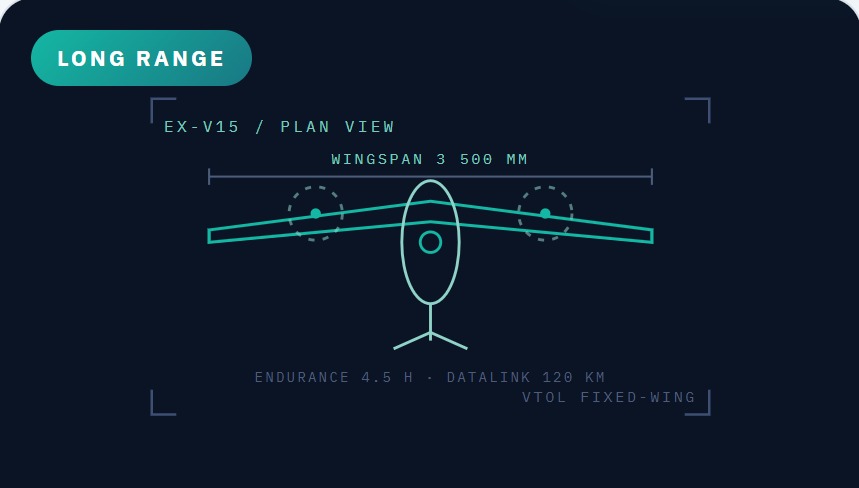
Long Range EX-V15 / PLAN VIEW VTOL FIXED-WING WINGSPAN 3 500 MM ENDURANCE 4.5 H · DATALINK 120 KM

EX-V15 SkyGuard

VTOL Surveillance Platform

Fixed-wing endurance with helicopter take-off. EO/IR gimbal and AI detection for border patrol, coastal monitoring and critical-asset security — day and night, ship-to-shore.

  • Endurance4.5 hours
  • Datalink120 km encrypted
  • PayloadEO/IR gimbal + AI tracking
  • Ideal foragencies, ESSZONE, ports
Get Pricing
Where We Fly

Eight missions, one partner

Purpose-built mission profiles for the sectors that drive Malaysia — from the granary belt to the city grid to the maritime border.

Paddy

Seeding, fertilising and spraying across the Kedah–Perlis granary belt. Terrain-follow keeps droplets uniform over flooded bunds.

Oil Palm

Canopy health surveys, Ganoderma early detection, and precision bagworm treatment across large estates.

Durian & Orchards

Flowering-stage foliar feeding and pest control in Raub and Gua Musang terrain too steep for ground crews.

Vegetables & Highland

Fine-mist crop protection for Cameron Highlands terraces — low drift, low water, no soil compaction.

Smart City & Urban Planning

3D digital twins for PBT and PLANMalaysia workflows — development control, flood modelling, slope risk and traffic corridor studies.

Border & Maritime Security

Persistent EO/IR patrol along land borders, ESSZONE waters and the Straits — AI detection of vessels, crossings and intrusions.

Oil, Gas & Energy

Flare stack, jetty and pipeline inspection plus solar-farm thermography — no shutdowns, no scaffolding, full digital records.

Utilities & Telco

Transmission-line corridors, substations and tower audits for grid and network operators — faster, safer, fully geotagged.

Exceed FieldOS

The software behind every flight

Drones collect the data. FieldOS turns it into decisions — one dashboard for agronomists, inspection engineers, city planners and security operators alike.

01

Mission Planning

Draw your block once; FieldOS generates optimised flight paths, no-fly buffers and battery swap points automatically.

02

Mission Analytics

NDVI trends, thermal anomaly reports, 3D city models and patrol logs — pushed to your phone in Bahasa Melayu or English.

03

Compliance & Records

Every flight, litre and image is logged with GPS proof — ready for MSPO audits, DOSH inspection records and agency reporting.

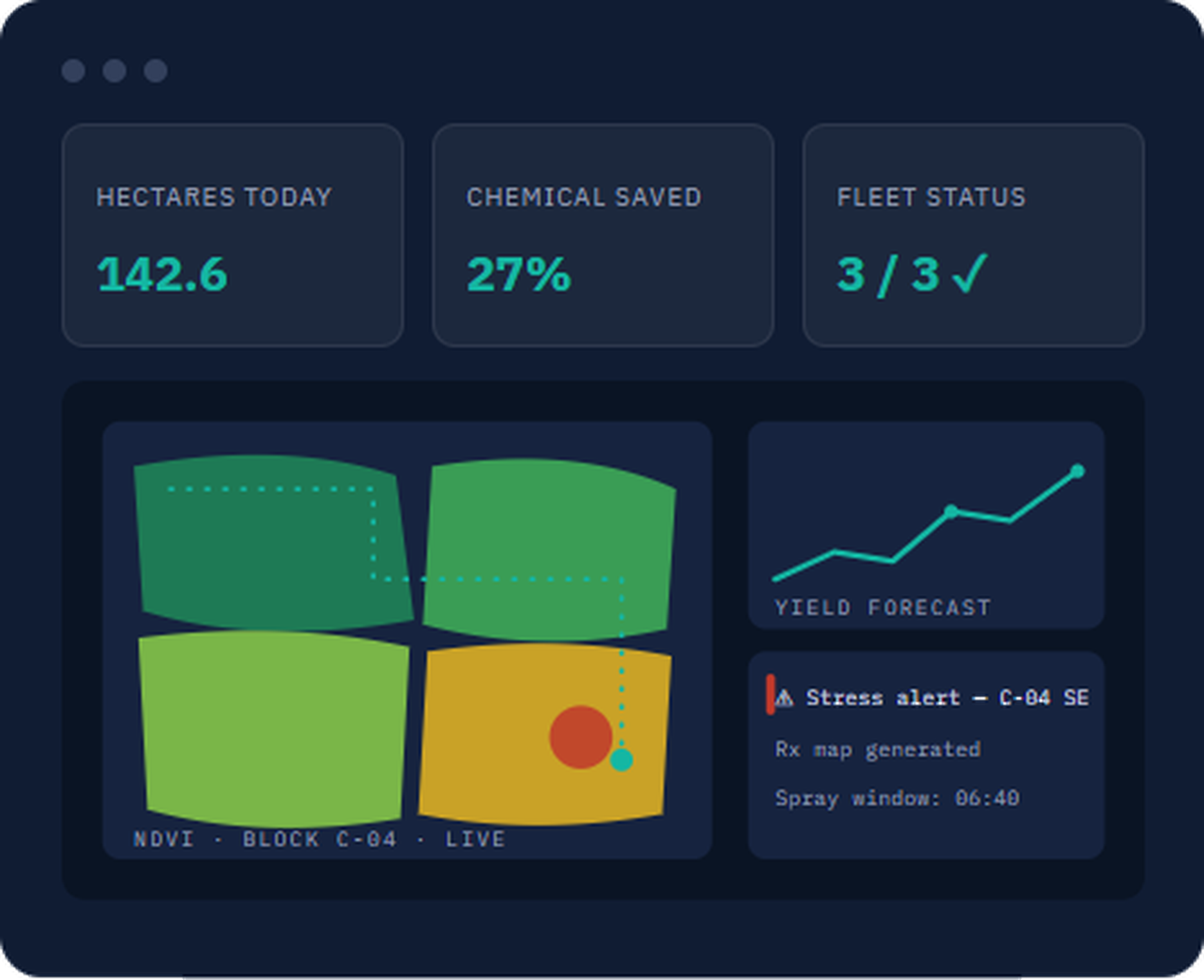
Hectares today142.6
Chemical saved27%
Fleet status3 / 3 ✓
NDVI · BLOCK C-04 · LIVE YIELD FORECAST ⚠ Stress alert — C-04 SE Rx map generated Spray window: 06:40
Why Exceed

Compliant, supported, and here to stay

Buying a drone is easy. Operating a fleet legally and profitably for five seasons is the hard part — that's what we're built for.

  • CAAM permit & pilot certification assistance included
  • Operator training academy — BM & English
  • Local parts, batteries & service within 48 hours
  • Financing & leasing schemes for co-ops and SMEs
  • MSPO / DOSH-ready digital records, exportable anytime
  • Secure on-premise data option for government & security work
Get In Touch

See it fly on your own site

Book a free demonstration — we'll bring the aircraft to your farm, plant, site or district, fly a real mission, and show you the data the same day.

Malaysia OperationsKuala Lumpur & Alor Setar service hubs
Exceed Tech Global Ltd.
Field Demo SlotsMonday – Saturday, weather permitting

Request a Demo